Trending:
Alabama Tornado: Radar Shows 9 Whirling Storms Spark Alarm, Twister Spotted In Lauderdale County | VIDEO
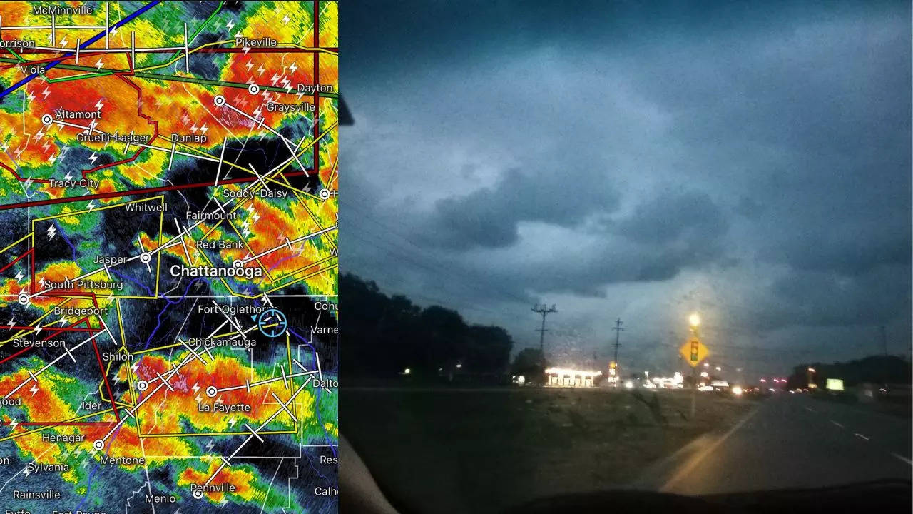
Amid the tornado warnings, nine powerful storms closer to one another are revolving near Alabama. This comes in the wake of the National Weather Service (NWS) alerts about possible twisters approaching the Southern State on Wednesday.

Updated May 9, 2024, 08:18 IST
A giant tornado was spotted on a highway in Alabama's Lauderdale County.
Amid the tornado warnings, nine powerful storms closer to one another are revolving near Alabama. This comes in the wake of the National Weather Service (NWS) alerts about possible twisters approaching the Southern State on Wednesday. The storms are also approaching Georgia amid a tornado watch in place, as shown on the radar. Meanwhile, a sweeper was spotted passing on a highway in Lauderdale County late in the evening. The video of the massive tornado was captured by a local storm chaser through his camera.
"It’s very active tonight in southern Middle Tennessee and North Alabama. At least 6 storms that are #tornado warned right now. 2 of them have confirmed tornadoes. A lot going on. #TNwx #ALwx,"
Craig Ceecee, a storm watch expert and meteorologist wrote in a post on X (formerly Twitter).
The NWS' office in Huntsville warned of a tornado warning being active until 10:00 pm, per local time, (CDT) for North Central Jackson and Southwestern Franklin Counties.
Based on radar-indicated rotation, the weather agency located a severe thunderstorm capable of producing a tornado at around 9:30 pm (CDT) over Huntland, or 14 miles southwest of Winchester. The storm was moving in the east with a pace of 25 mph.
The dangerous storm was be closer to Huntland at around 9:35 pm (CDT). Other locations impacted by this tornadic thunderstorm include Maxwell, Francisco, Beans Creek, Belvidere, Jericho, and Hytop.
The weather in Alabama is going to be marred by heavy rain showers and thunderstorms Wednesday night. "A 40 percent chance of showers and thunderstorms, mainly after 1am. Mostly cloudy, with a low around 72. South wind around 10 mph," the NWS weather forecast informed. Showers likely and possibly a thunderstorm before 1 pm (CBT) have been predicted for tomorrow as well.


Trending:
End of Article
Subscribe to our daily Newsletter!
Related News


Ukrainian Girl’s Deepfake Promotes Russia In Mandarin On Chinese Social Media

5 Injured In Knife Attack At Primary School In China

Who Is Mohammad Mokhber? Iran's VP Takes Over As President After Ebrahim Raisi's Death

'It Wasn't Us': Why Israel Issued Clarification After Iran President's Death In Helicopter Crash

Who Was Ebrahim Raisi? 5 Facts About Late Iranian President