Severe thunderstorm warning issued for WLKY viewing area

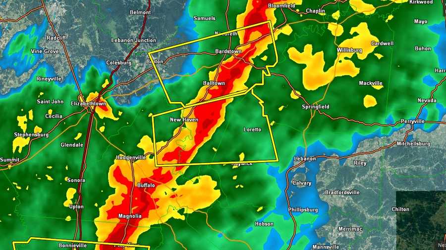
A severe thunderstorm warning will be in effect for parts of our area until 8 p.m. Saturday.
Howling winds have already knocked out power in the viewing area. LG&E reports, as of 1 p.m., approximately 1,700 outages in Kentucky.
In Clinton county, Indiana, a Wal-Mart roof reportedly collapsed.
In Jefferson County, there are reports of trees down on Dugan Hollow Road, possibly making the road impassable.
Wind gusts have reached speeds of more than 40mph this morning and afternoon. Stronger winds will be possible with a strong cold front tracking in from the northwest.
Our greatest potential for severe weather will be as that front moves through our region.
The primary weather threat will be for damaging winds.
After the front passes through, our winds will shift bringing in sharply colder air. Highs tomorrow will only be in the 30s.