RAIN AND WIND TUESDAY
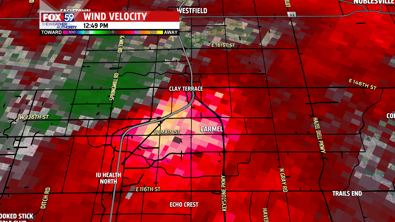
Damaging wind gusts toppled trees and power-lines in parts of central Indiana for the second time in 5 days. We measured a 58 mph gust at the studios of Fox 59 just after 12:30 PM Tuesday.
Look at the huge tree that fell on this house in Camel. Radar estimated a compact area of 60+ mph winds roaring across Hamilton county and into Carmel just before 1 pm.

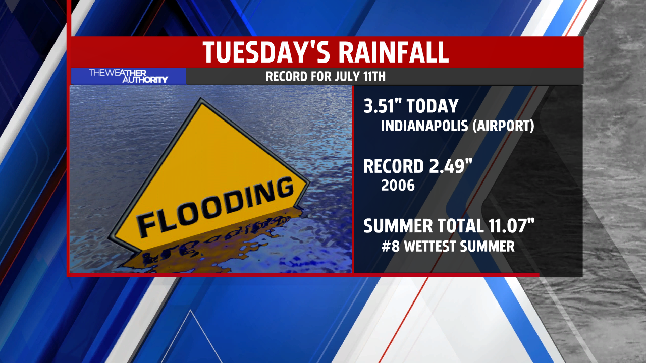
RECORD RAINFALL FOR THE DATE
The final rain total in Indianapolis is 3.51″ – a record for the date and the largest single day rainfall since July of 2015.
Nearing the half way point of summer, we are now over 11″ of rainfall and currently the 8th wettest summer on record to date!

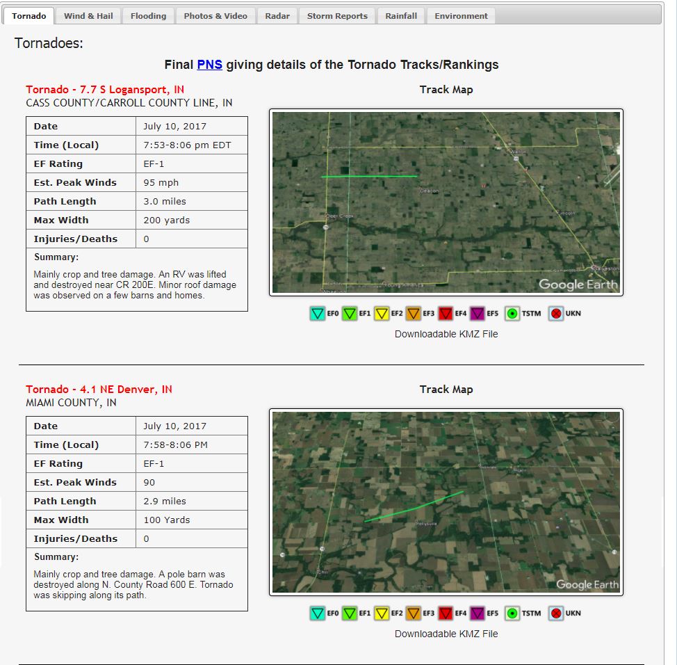
TORNADOES CONFIRMED
The National Weather Service from North Webster confirmed two tornadoes Monday – one in Carroll county (EF-0 75 mph winds) becoming a EF-1 in Cass county with 90 mph winds. An Additional tornado (EF-1 90 mph) was confirmed in Miami county as well four miles northeast of Denver, Indiana.

These are the first tornadoes of the summer in the state. the last tornado reports came May 20th in Benton, White,Clinton and Boone counties to the north and Jefferson county to our south.
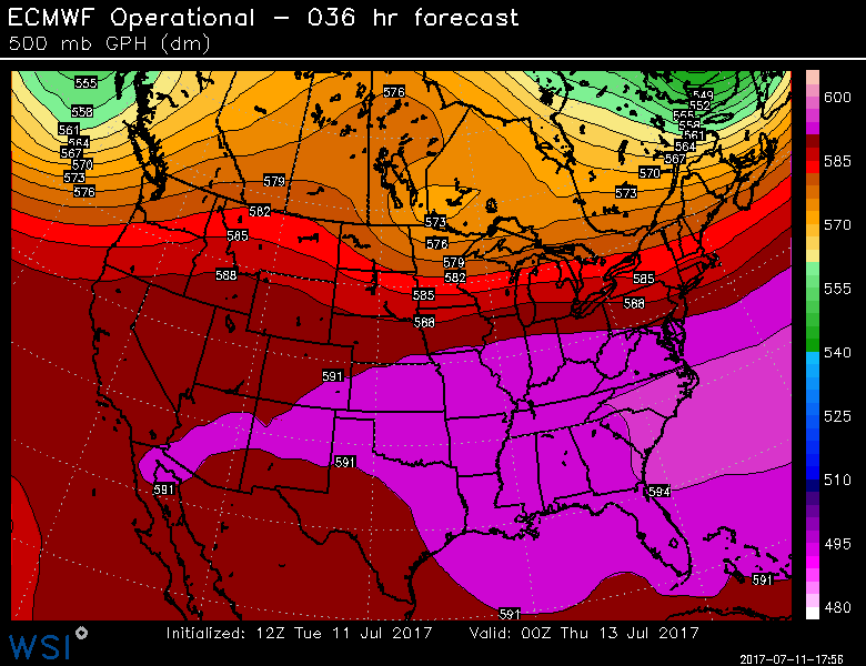
PATTERN TO CONTINUE
The heat is spreading north but not that far east. This is the NORTHWEST FLOW pattern we highlighted last week that would take hold. The flow of jet stream winds north of the HOT DOME and core of heat will be the focus for many clusters of new thunderstorms over the next 24 hours. These look to remain mainly north then settle south by Thursday morning. We will monitor, We are expecting quieter times tonight and Wednesday but it may turn storm again by early Thursday morning. We will keep you posted!

HIGHEST HEAT INDEX OF THE SUMMER
With a break from the storms and slight jog north of the jet stream it will heat up here the next two days. We haven’t reached 90-degrees in over three weeks but Wednesday and Thursday will come close. Regardless of the high temperature the way it feels – the HEAT INDEX could reach 100° in some locations. Stay hydrated and take frequent breaks if you are outdoors Wednesday and Thursday afternoon.

